
Centreville, VA Real Estate: The Definitive Guide to Homes, PUDs & Bull Run Parkland
1. Executive Summary & Foundational Takeaways
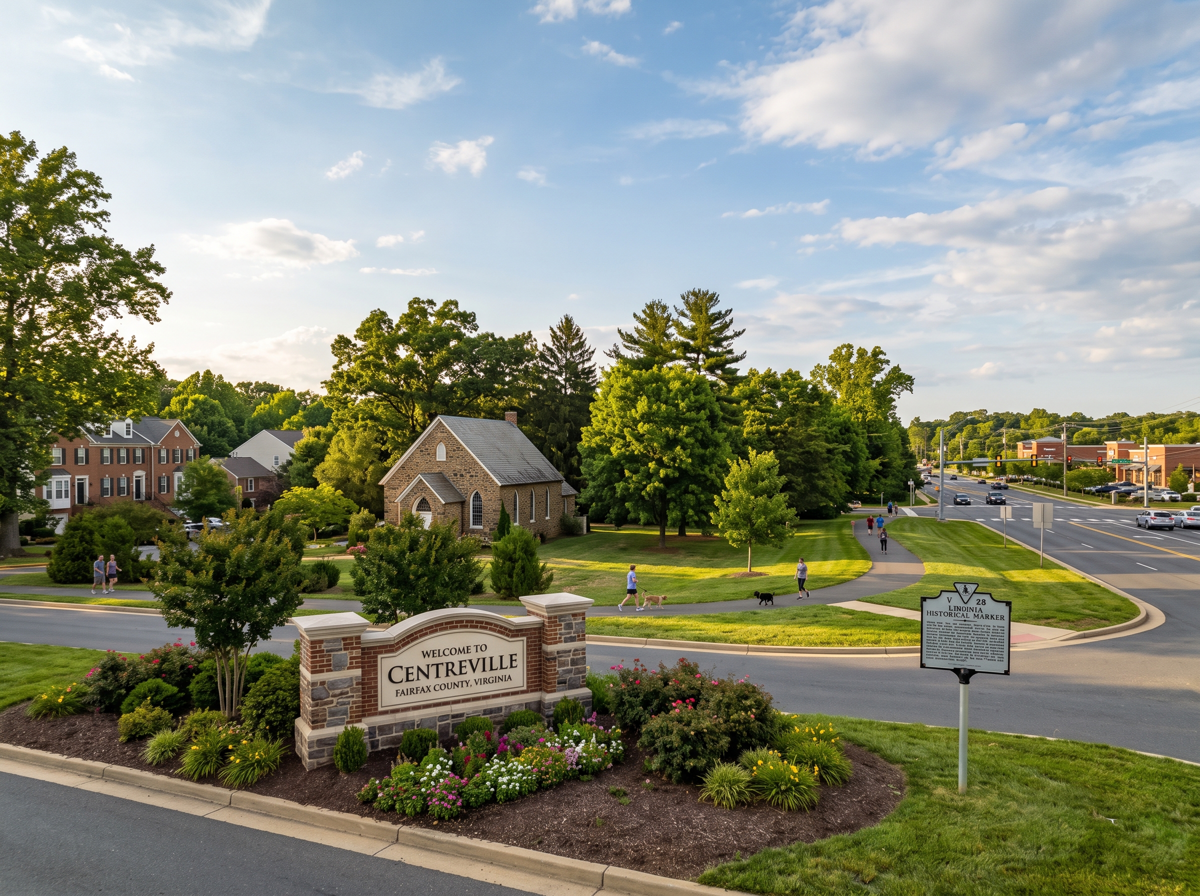
Centreville, Virginia, occupies a commanding geographic position in western Fairfax County. Located twenty-one miles west of Washington, D.C., at the convergence of Interstate 66, Route 28 (Sully Road), and Route 29 (Lee Highway), Centreville functions as the residential anchor of the southwestern county corridor.
Administered under unincorporated Fairfax County (split between the Sully and Springfield Magisterial Districts across ZIP Codes 20120 and 20121), Centreville possesses a rich civic heritage. It holds the distinction of being Fairfax County’s earliest planned municipality, originally chartered by the Virginia General Assembly in 1792. Today, Centreville is celebrated for its mature Planned Unit Developments (PUDs)—including Virginia Run, Little Rocky Run, Sully Station, Faircrest, and Centre Ridge—providing high architectural stability, extensive private recreation facilities, and exceptional connectivity to the Washington Metropolitan employment core.
The Six Structural Pillars of Centreville Real Estate
- First Chartered Municipality in Fairfax County (1792). An authentic 18th-century crossroads history combined with late-20th-century master-planned community execution.
- Large-Scale Master-Planned Communities. Subdivisions like Little Rocky Run (over 2,000 homes), Sully Station (1,971 homes), Virginia Run (1,400+ homes), and Faircrest (1,300+ homes) offer private pools, tennis courts, and walking trails maintained through established community associations.
- Dual High School Academic Pyramids. Anchored by Centreville High School (AP Capstone) and Westfield High School, supported by elementary centers such as Colin Powell Elementary's Korean Language Immersion Program.
- Occoquan Reservoir Watershed Downzoning Protections. Stringent environmental protections across the Occoquan drinking water reservoir basin, limiting regional density and enforcing 100-foot Resource Protection Area (RPA) buffers.
- Interstate 66 & Route 28 Arterial Hub. Immediate connectivity to the dynamically tolled I-66 Express Lanes, the grade-separated Route 28 freeway, and the Stringfellow Road Park & Ride commuter transit center.
- Bull Run Parkland & Regional Recreation. Over 1,500 contiguous acres of protected parkland at Bull Run Regional Park, the Atlantis Waterpark, and the Bull Run Occoquan Trail along the community's southern boundary.
Quick Navigation: Centreville Monograph Sections
2. Comprehensive Historical Evolution
In the 18th century, western Fairfax County developed around vital overland turnpikes that linked Alexandria and Colchester on the Potomac with Shenandoah Valley agricultural centers. Centered on Newgate Tavern, a crossroads hamlet known as Newgate emerged to service westward travelers, drovers, and merchants.
Recognizing the strategic necessity of an inland municipal trading center, the Virginia General Assembly formally incorporated the town of "Centerville" on December 15, 1792. The name was chosen to denote its central location equidistant from Alexandria, Colchester, Dumfries, Leesburg, Middleburg, and Warrenton. Centerville was surveyed into half-acre village lots flanking a central public square, establishing it as Fairfax County’s earliest planned municipality.
The Civil War Crucible: Manassas Battles & Winter Encampments (1861–1862)
Due to its commanding topography overlooking Bull Run and the rail junction at Manassas, Centreville was a focal point of military operations during the Civil War:
- First & Second Battles of Manassas: Union armies advanced through Centreville along the Warrenton Turnpike (modern Route 29) to engage Confederate forces along Bull Run in July 1861 and August 1862.
- The Confederate Winter Encampment & "Quaker Guns": During the winter of 1861–1862, Confederate General Joseph E. Johnston fortified Centreville into a military stronghold. Over 40,000 Confederate soldiers constructed extensive earthwork redoubts and winter log huts. When Johnston withdrew south in March 1862, advancing Union troops discovered that many fortified artillery lunettes were mounted with "Quaker guns"—pine logs stripped of bark and painted black to mimic heavy siege cannon, successfully bluffing Federal reconnaissance for months.
- Historic Landmarks: The Centreville Historic District preserves key wartime structures, including Mount Gilead (an 18th-century vernacular tavern and dwelling utilized as Johnston's headquarters) and St. John's Episcopal Church (erected in 1854, utilized as a military field hospital, where soldiers scratched their names into the interior plaster).
Suburban Master-Planning & Modern Boom (1980–Present)
Following decades as a rural dairy farming village, Centreville was transformed in the 1980s by the extension of Interstate 66 and the modernization of Route 28. Master-plan developers acquired farmland to build cohesive residential communities, establishing Centreville as a premier residential destination in the National Capital Region.
3. Physical Geography, Topography & Hydrology
Centreville lies within the Culpeper Basin of the Piedmont Physiographic Province, transitioning toward the Bull Run Mountain foothills:
- Topography & Elevation: Elevations range from 240 feet along the southern Bull Run floodplains to 410 feet across the ridges of Virginia Run and Little Rocky Run. The terrain features rolling hills and dendritic stream valleys.
- Geology & Soils: The bedrock belongs to the Newark Supergroup (Triassic red siltstone, shale, and sandstone). Soils belong to the Penn-Bucks and Orange-Kelly complexes, composed of silty clay loams with moderate shrink-swell characteristics, requiring engineered foundation drainage and positive surface grading away from basement walls.
Watersheds & The Occoquan Reservoir Protection District
Centreville is drained by three major stream systems: Cub Run, Big Rocky Run, and Little Rocky Run, all flowing into Bull Run.
Because Bull Run feeds directly into the Occoquan Reservoir—a drinking water source for over one million Northern Virginia residents—Fairfax County enacted environmental downzoning across the southern Occoquan basin in 1982. This zoning limits baseline density to one dwelling unit per five acres in conservation areas and enforces strict stormwater management standards. Additionally, under the Chesapeake Bay Preservation Act, 100-foot Resource Protection Area (RPA) vegetative buffer zones protect all perennial streams, prohibiting land disturbance and preserving pristine forested stream valleys.
4. The Complete Centreville Neighborhood Dossier
Virginia Run (1,400+ Homes, ZIP 20120)
Spanning over 1,200 acres in western Centreville along Pleasant Valley Road, Virginia Run is an executive master-planned community comprising over 1,400 detached single-family residences. The neighborhood features custom and semi-custom center-hall brick colonials situated on one-third to full-acre parcels. Community amenities include the historic 18th-century Moore House park, a community clubhouse, an Olympic-size competition pool with a swim team, lighted tennis and pickleball courts, and walking paths connecting into Bull Run Regional Park.
Little Rocky Run (2,000+ Homes, ZIP 20120 & 20121)
Little Rocky Run is one of Northern Virginia's most celebrated master-planned communities, comprising over 2,000 homes (single-family detached, townhomes, and patio homes) across 950 acres between Route 28 and Route 29. The community features three separate recreation centers, three swimming pools, seven tennis courts, multiple basketball courts, children's playgrounds, and miles of shaded walking trails through Big Rocky Run stream valley.
Sully Station & Sully Station II (1,971 Units, ZIP 20120)
Developed in the late 1980s and 1990s west of Route 28, Sully Station encompasses 1,971 residences (detached single-family colonials and garage townhomes) centered on community recreation facilities with pools, tennis courts, and athletic fields. Its direct access to Route 28 ramps makes it highly desirable for aerospace and defense commuters working in Westfields and the Dulles Technology Corridor.
Centre Ridge (1,269 Units, ZIP 20121)
Centre Ridge is a centrally located planned community comprising 1,269 residences, offering a dynamic mix of single-family colonials, fee-simple townhomes, and garden condominiums. Amenities include community swimming facilities, tennis courts, and direct pedestrian access to the Centre Ridge Marketplace commercial promenade and Cinemark Centreville movie theater complex.
Faircrest & Stonegate at Faircrest (1,300+ Units Combined, ZIP 20120)
Positioned immediately off Interstate 66 and the Fairfax County Parkway, Faircrest (encompassing Faircrest, Faircrest North, Faircrest South, and Stonegate at Faircrest) is a premier master-planned enclave. It offers luxury executive single-family colonials and spacious garage townhomes centered on a private clubhouse, swimming pool, soccer fields, and lakeside walking trails.
Country Club Manor & Cabells Mill (1,248 Units Combined, ZIP 20120)
Bordering Ellanor C. Lawrence Park, Country Club Manor (939 units) and Cabells Mill (309 units) are established communities featuring classic colonials and split-levels on wooded homesites. Residents enjoy direct walking access to historic Cabell's Mill, Walney Pond, and nature center trails.
Compton Village & London Towne (1,734 Units Combined)
Compton Village (535 units) features colonial single-family residences and townhomes around a private pool and tennis complex. London Towne (1,199 units across London Towne and London Towne West) represents one of Centreville’s early residential pillars, offering affordable fee-simple townhomes and community pool facilities near Route 29.
Historic Centreville Core (ZIP 20121)
Centered along Route 29 (Lee Highway) and Mount Gilead Road, this historic enclave contains preserved structures from the 18th and 19th centuries interspersed with boutique infill residences, operating under the advisory guidance of the Fairfax County Architectural Review Board.
5. Architectural Typologies
- Historic 18th- & 19th-Century Vernacular: Heavy timber framing over coursed stone foundations, central chimneys, lap wood siding, and metal roofs, exemplified by Mount Gilead and St. John's Church.
- Executive Center-Hall Colonials (1980–1998): The architectural anchor of Virginia Run, Little Rocky Run, and Faircrest, featuring poured-concrete basements, two-story brick-front facades, two-story entrance foyers, Palladian windows, rear family rooms with masonry fireplaces, and attached two-car side-load or front-load garages.
- Master-Planned Garage Townhomes (1988–2005): Three-level fee-simple brick townhomes with single- or two-car garages, second-story open floor plans, rear outdoor dining decks, and walk-out basements found throughout Sully Station and Centre Ridge.
- Suburban Split-Levels & Ramblers (1970–1980): Mature single-level ranches and multi-level split-foyer homes with brick-and-siding exteriors, located in early residential subdivisions such as Country Club Manor and London Towne.
6. Municipal Zoning & Land-Use Code
Centreville operates under the Fairfax County Zoning Ordinance (zMOD):
- Planned Development Housing (PDH): The primary zoning classification governing Virginia Run, Little Rocky Run, Sully Station, and Faircrest. PDH zoning allows clustered footprints in exchange for dedicated open space, recreational amenities, and trail grids.
- R-C (Residential-Conservation): Applied across the Occoquan basin along Centreville’s southern perimeter, restricting baseline residential density to one dwelling unit per five acres to preserve regional drinking water quality.
- Centreville Historic Overlay District (HOD): Administered by the Fairfax County Architectural Review Board to preserve the visual character and historic architecture of the 18th-century crossroads settlement.
7. Educational Ecosystem & School Pyramids
Public education in Centreville is administered by Fairfax County Public Schools (FCPS) across two main high school pyramids:
- Centreville High School Pyramid: Centered on Centreville High School (acclaimed for its AP Capstone diploma program and championship athletics), fed by Liberty Middle School, Centreville Elementary, Union Mill Elementary, and Colin Powell Elementary.
- Colin Powell Elementary Partial Korean Immersion: A nationally recognized dual-language immersion program where students receive partial instruction in Korean starting in kindergarten.
- Westfield High School Pyramid: Serving western Centreville (including Virginia Run), fed by Stone Middle School and Virginia Run Elementary.
- Regional STEM Magnet (TJHSST): Students across all pyramids are eligible to apply to the prestigious Thomas Jefferson High School for Science and Technology (TJHSST) in Alexandria.
8. Multi-Modal Commuting & Regional Arterials
- Interstate 66 & I-66 Express Lanes: The central east-west highway providing dynamically tolled express access eastward toward the Capital Beltway (I-495), Tysons, and Washington, D.C.
- Route 28 (Sully Road): A grade-separated multi-lane freeway connecting Centreville directly north to Dulles Airport, the Silver Line Metro, and Route 267.
- Route 29 (Lee Highway): The historic commercial arterial running parallel to I-66, providing vital local redundancy.
- Stringfellow Road Park & Ride Transit Center: A regional transit center featuring structured parking, EV charging, and direct express bus service to the Vienna / Fairfax-GMU Orange Line Metrorail Station.
9. Parks, Recreation & Culinary Life
- Bull Run Regional Park: Spanning over 1,500 contiguous acres along Centreville’s southern border, operated by NOVA Parks. Features the Atlantis Waterpark, disc golf courses, camp sites, the 19.7-mile Bull Run Occoquan Trail, and the annual Festival of Lights.
- Ellanor C. Lawrence Park: A 650-acre nature sanctuary on Centreville’s northern boundary featuring historic 18th-century farmsteads, the Walney Visitor Center, and forested hiking paths along Big Rocky Run.
- Northern Virginia's International Culinary Capital: Centreville is celebrated across the Mid-Atlantic as a culinary destination, featuring an authentic density of Korean dining, international markets (H Mart, Lotte Plaza), artisanal bakeries (Shilla, Paris Baguette), and the regional wellness destination Spa World.
- Centreville Day: An annual community festival held in the Historic Centreville district, celebrating local history with parades, artisan crafts, food vendors, and live entertainment.
10. Fiscal Architecture, Taxation & HOA Nuances
Under Virginia Code Title 58.1-3201, all real estate is assessed annually at 100 percent of fair market value by the Fairfax County Department of Tax Administration:
- Zero Municipal Town Taxes: Centreville property owners pay only the Fairfax County base real estate levy, the county stormwater management service district assessment, and regional transit fees, with no municipal town taxes.
- Mandatory Master Planned Community HOAs: Over 85 percent of homes are governed by established HOAs (e.g., Virginia Run, Little Rocky Run, Sully Station, Faircrest) that manage private recreation centers, swimming pools, tennis courts, and walking trails while maintaining long-term capital replacement reserves governed by state-mandated reserve studies.
- Conforming vs. Jumbo Underwriting: Real estate financing transitions between FHFA high-cost conforming baseline limits and jumbo portfolio financing, with jumbo underwriting requiring larger liquid asset reserves for luxury estate properties.
11. Strategic Buyer Guidance
- Resource Protection Area (RPA) Review: Inspect Fairfax County GIS maps to verify whether 100-foot RPA easements along Cub Run or Rocky Run affect buildable lot space.
- Foundation Drainage Inspection: Inspect basement perimeter French drains, sump pump operation, and battery backups to safeguard against moisture in clay-rich Triassic soils.
- HOA Resale Disclosure Audit: Examine community association financial statements, capital reserve funds, and architectural covenants during the statutory contract review period.
12. Strategic Seller Guidance
- Staging Traditional Colonials: Emphasize center-hall symmetry, two-story entrance foyers, open kitchen-to-family-room flow, and finished basements.
- Showcasing Community Recreation: Highlight community association amenities, including swimming pools, swim teams, tennis/pickleball courts, and walking paths.
- Commuter Optimization: Highlight quick access to the I-66 Express Lanes, Route 28, and the Stringfellow Road Park & Ride transit facility.
13. Submarket Comparative Matrix
| Submarket | Governance | Typical Lot Dimensions | Zoning Framework | Primary Commuter Spine | Dominant Architecture |
|---|---|---|---|---|---|
| Centreville (Fairfax) | Unincorporated Fairfax County (Sully/Springfield) | 9,000 to 20,000+ sq ft | Fairfax County zMOD (PDH, R-2, R-3) | Interstate 66 & Route 29 Express | Executive Brick Colonials, Large-Scale PUDs |
| Chantilly (Fairfax) | Unincorporated Fairfax County (Sully District) | 10,000 to 18,000 sq ft | Fairfax County zMOD (R-3, PDH, PDC) | Route 28 & Route 50 to Silver Line | Executive Brick Colonials, Garage Townhomes |
| Town of Herndon | Incorporated Town (Mayor, Council, Police, DPW) | 8,000 to 15,000 sq ft | Town Code (Ch. 78) & ARB Overlay | Herndon Metrorail Station (Silver Line) | Historic Victorians, Craftsman Bungalows |
| Clifton (Fairfax) | Incorporated Town & Rural Estate Enclave | 1 to 5+ Acres (Historic Town: 1/4 to 1/2 Acre) | Town of Clifton Code / Fairfax County R-C | Route 29 & Clifton Road to VRE Commuter Rail | Historic Frame Cottages, Multi-Acre Manors |
| Reston (Fairfax) | Unincorporated Master-Planned PUD | Variable (Clustered to 1/3 Acre) | Fairfax County zMOD & Reston DRB | Silver Line Heavy Rail & Dulles Toll Road | Mid-Century Modern, Urban High-Rises |
14. 10 Comprehensive Evergreen FAQs
1. Is Centreville an incorporated town or part of Fairfax County?
Centreville is an unincorporated community and census-designated place (CDP) within Fairfax County, split between the Sully and Springfield Magisterial Districts. While originally chartered as a town in 1792 by the Virginia General Assembly (making it the first chartered town in Fairfax County), its municipal charter later lapsed. Municipal services, police protection, public schools, and zoning enforcement are administered directly by Fairfax County.
2. Where does the name "Centreville" originate?
Originally known as the crossroads settlement of Newgate, the community was incorporated as "Centerville" in 1792 due to its central geographic location equidistant between Alexandria, Colchester, Dumfries, Leesburg, Middleburg, and Warrenton.
3. What public high school pyramids serve Centreville?
Centreville is served primarily by the Centreville High School pyramid (fed by Liberty Middle School, Centreville Elementary, Colin Powell Elementary, and Union Mill Elementary) and the Westfield High School pyramid (fed by Stone Middle School and Virginia Run Elementary). Colin Powell Elementary hosts a nationally celebrated Korean Language Immersion Program.
4. What are the largest master-planned communities in Centreville?
The premier master-planned communities in Centreville include Little Rocky Run (over 2,000 homes with three recreation centers and pools), Sully Station (1,971 homes), Virginia Run (1,400+ executive colonials on one-third to full-acre lots), Faircrest (1,300+ homes), and Centre Ridge (1,269 homes).
5. How are real estate taxes structured in Centreville?
Real estate is assessed annually at 100 percent of fair market value by the Fairfax County Department of Tax Administration under Virginia Code Title 58.1. Homeowners pay the countywide base real estate levy, the county stormwater management service district fee, and regional transportation funds, with zero municipal town taxes.
6. Do homes in Centreville have mandatory Homeowners Associations (HOAs)?
More than 85 percent of residences in Centreville are located within mandatory Planned Unit Developments (PUDs) with active HOAs. These associations maintain private community clubhouses, swimming pools, tennis/pickleball courts, and miles of paved walking trails, while enforcing architectural design covenants.
7. What is the Occoquan Reservoir Watershed Protection District in Centreville?
The Occoquan Reservoir is a primary drinking water reservoir serving over one million Northern Virginia residents. Much of southern Centreville drains into this basin via Cub Run and Bull Run. In 1982, Fairfax County enacted historic environmental downzoning across the basin to protect drinking water quality, restricting baseline residential densities to one dwelling unit per five acres in conservation areas.
8. What commuter transit options connect Centreville to Washington, D.C.?
Centreville features direct access to Interstate 66, the dynamically tolled I-66 Express Lanes, Route 28, and Route 29. The Stringfellow Road Park & Ride Transit Center provides commuter parking and direct express bus service to the Vienna / Fairfax-GMU Orange Line Metrorail Station.
9. What role did Centreville play in the Civil War?
Centreville was a critical military hub during both Battles of Manassas (Bull Run). In the winter of 1861–1862, Confederate General Joseph E. Johnston fortified the village with massive earthworks and over 40,000 soldiers, famously using black-painted wooden "Quaker guns" to bluff Union reconnaissance. Historic landmarks include Mount Gilead and St. John's Episcopal Church.
10. What major parks and recreational facilities are located in Centreville?
Major amenities include Bull Run Regional Park (spanning 1,500+ acres with the Atlantis Waterpark and the Bull Run Occoquan Trail), Ellanor C. Lawrence Park along Centreville’s northern boundary, and the nearby Cub Run RECenter.
Legal Disclaimer: This monograph is published solely for educational, historical, and general analytical purposes. It does not constitute formal legal counsel, structural engineering analysis, municipal land-use determination, or real estate brokerage representation. All zoning ordinances, environmental setbacks, land development conditions, school boundary pyramid assignments, and tax assessments are subject to periodic administrative review, legislative amendment, and legal revision by the Fairfax County Board of Supervisors and the Commonwealth of Virginia. Prospective purchasers and sellers are advised to independently verify all property-specific details with Fairfax County Land Development Services, the Fairfax County Department of Tax Administration, and Fairfax County Public Schools.
Equal Housing Opportunity: This publication operates in strict compliance with the Federal Fair Housing Act of 1968 (42 U.S.C. § 3601 et seq.), the Virginia Fair Housing Law (Virginia Code § 36-96.1 et seq.), and all applicable local civil rights ordinances. Real estate opportunities described herein are offered without discrimination based on race, color, religion, sex, handicap, familial status, national origin, elderliness, sexual orientation, gender identity, military status, or source of funds.