
Chantilly, VA Real Estate: The Definitive Guide to Homes, Tech Corridors & Communities
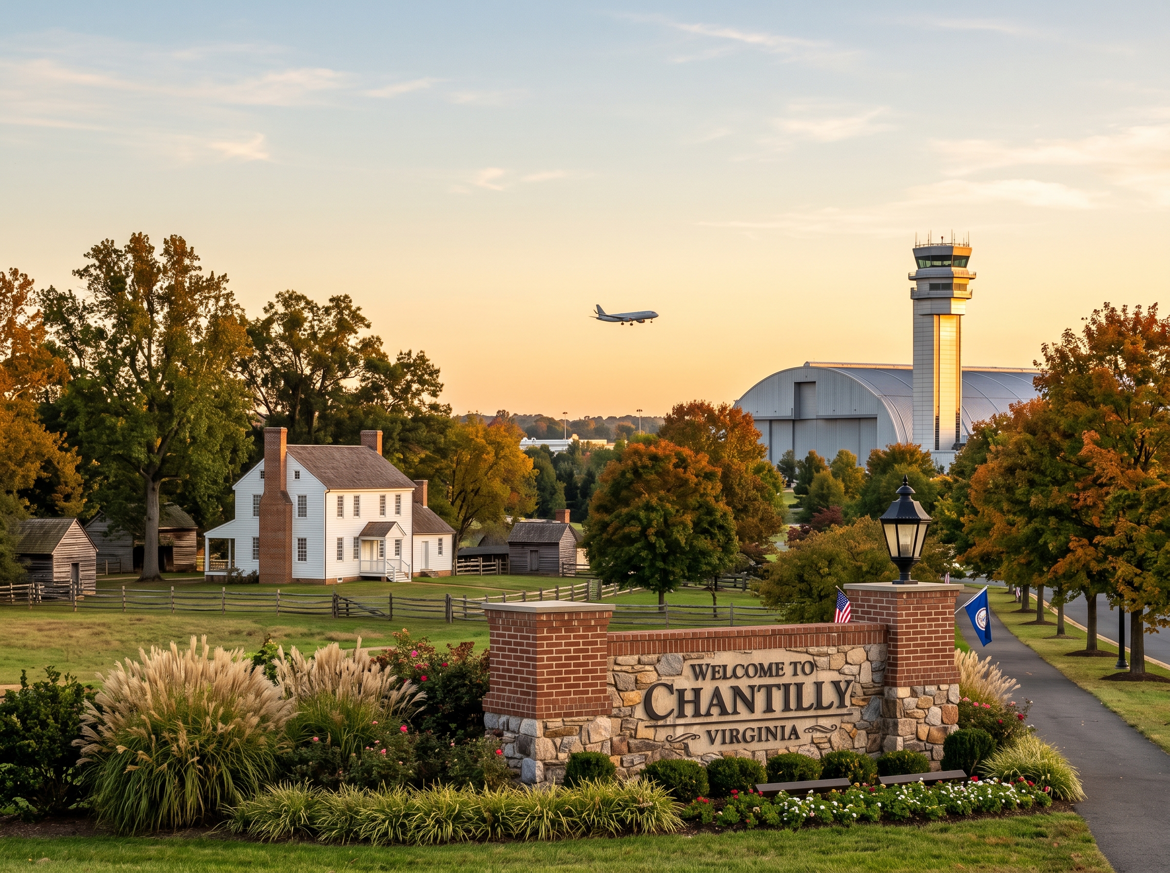
1. Executive Summary & Foundational Takeaways
Chantilly, Virginia, occupies a pivotal geographic and economic position within the outer suburban ring of the Washington Metropolitan Area. Situated twenty-four miles west of Washington, D.C., in western Fairfax County, Chantilly functions as both an affluent residential enclave and the premier aerospace, defense, and intelligence technology node of Northern Virginia.
A defining characteristic of Chantilly is its inter-county spatial organization. Eastern Chantilly (ZIP Code 20151) lies entirely within unincorporated Fairfax County (governed under the Sully Magisterial District), encompassing established master-planned residential communities such as Poplar Tree Estates, Brookfield, Pleasant Valley, Greenbriar, and Armfield Farms, as well as the corporate employment campus of Westfields International Center. Western Chantilly (ZIP Code 20152) crosses the county line into Loudoun County, transitioning into large master-planned communities such as South Riding and Stone Ridge. This monograph focuses primarily on the Fairfax County sector of Chantilly, analyzing its historical foundations, physical topography, zoning ordinances, and real estate morphology.
The Six Structural Pillars of Chantilly Real Estate
- Federal Aerospace & Defense Cluster. Anchored by the National Reconnaissance Office (NRO) headquarters and major aerospace engineering campuses in Westfields, providing durable employment demand among high-clearance defense contractors.
- Chantilly High School Governor’s STEM Academy. A recognized academic powerhouse featuring specialized career technical education in engineering, cybersecurity, and biomedical sciences that anchors neighborhood property demand.
- Route 28 & Route 50 High-Speed Arterial Nexus. A grade-separated expressway grid providing traffic-light-free connections north to Washington Dulles International Airport and the Silver Line Metrorail, and east toward the Capital Beltway.
- Cub Run & Flatlick Branch Watershed Buffers. Strict environmental stewardship under the Chesapeake Bay Preservation Act, enforcing 100-foot Resource Protection Area (RPA) vegetative zones that preserve stream valley forests.
- Unincorporated County Governance (Zero Municipal Town Tax). Homeowners pay only the Fairfax County base real estate levy, avoiding the dual municipal tax burdens found in incorporated towns while receiving comprehensive county municipal services.
- Master-Planned Community Infrastructure. High concentrations of mature Planned Unit Developments (PUDs) offering private swimming facilities, tennis courts, and walking trails maintained through established community associations.
Quick Navigation: Chantilly Monograph Sections
2. Comprehensive Historical Evolution
In the 18th century, western Fairfax County was carved into large agricultural patents under the Northern Neck Proprietary. Prominent Virginian dynasties—including the Lees, Turbervilles, and Stuarts—established tobacco plantations across the rolling Piedmont landscape.
The name Chantilly originated with the late-18th-century plantation founded by Charles Calvert Stuart along modern Route 50, named in tribute to the Château de Chantilly in France. Agricultural transportation was revolutionized by the chartering of the Little River Turnpike in 1802. As one of America's earliest privately financed paved turnpikes, it linked Alexandria with the agricultural interior of Aldie, creating a durable commercial trade route that stimulated crossroads settlements, grist mills, and roadside taverns.
The Battle of Chantilly / Ox Hill (September 1, 1862)
During the Civil War, Chantilly became the scene of fierce military conflict. Immediately following the Confederate victory at Second Manassas (Bull Run), Confederate General Thomas J. "Stonewall" Jackson attempted a flanking maneuver along the Little River Turnpike to cut off the retreating Union Army.
On September 1, 1862, during a violent late-afternoon thunderstorm, Union and Confederate forces collided at Ox Hill. The battle claimed the lives of two Union division commanders: Major General Philip Kearny and Brigadier General Isaac Stevens. Today, Ox Hill Battlefield Park, situated off West Ox Road, preserves a portion of this battlefield, providing an archival historical anchor within the modern suburban community.
Suburban Transformation & The Aerospace Nexus (1960–Present)
Through the mid-20th century, Chantilly remained an agrarian community characterized by dairy farms, timber stands, and gravel roads. The opening of Washington Dulles International Airport in 1962 initiated an economic transformation.
Beginning in the 1980s, large tracts of farmland were master-planned into residential communities, accompanied by the removal of traffic signals along Route 28 (Sully Road). Concurrently, the development of the Westfields International Center corporate park established Chantilly as an aerospace and intelligence powerhouse, anchored by the National Reconnaissance Office (NRO) headquarters and regional research campuses for major federal systems contractors.
3. Physical Geography, Topography & Hydrology
Chantilly is located within the Culpeper Basin of the Piedmont Physiographic Province:
- Piedmont Elevations: Terrain ranges from 280 feet above sea level in the southern stream bottoms to 390 feet across the residential ridges of Poplar Tree Estates. The topography consists of broad, gently sloping ridges dissected by tributary streams.
- Geology & Soil Profiles: The underlying bedrock consists of Triassic sedimentary rocks (siltstones, sandstones, and shales of the Bull Run formation). Soils belong predominantly to the Penn-Bucks and Orange-Kelly complexes, characterized by silty clay loams with moderate shrink-swell potential, requiring engineered foundation drainage systems.
Watershed Systems & 100-Foot RPA Buffer Enforcement
Chantilly’s drainage network is governed by two principal stream corridors:
- Cub Run Watershed: The major hydrological spine of western Fairfax County, carrying surface waters south toward Bull Run and the Occoquan River.
- Flatlick Branch: An extensive tributary that meanders through Ellanor C. Lawrence Park and Poplar Tree Estates, supporting mature riparian forests and wetland ecosystems.
Under the Chesapeake Bay Preservation Act (Virginia Code § 62.1-44.15:67 et seq.), Fairfax County enforces mandatory 100-foot Resource Protection Area (RPA) vegetative buffers landward of all perennial streams. Within this 100-foot buffer, clearing, grading, and the construction of permanent structures (such as swimming pools, room additions, and detached garages) are prohibited by law, permanently safeguarding stream banks while dictating buildable residential lot footprints.
4. The Complete Chantilly Neighborhood Dossier
Greenbriar (ZIP 20151 & 22033 Border)
Comprising over 1,900 single-family residences platted along the Route 50 corridor, Greenbriar is one of the most established and recognizable planned neighborhoods in western Fairfax County. Developed between 1965 and 1975, the community features classic split-levels, brick ramblers, and center-hall colonials shaded by towering oak and maple canopies. Greenbriar hosts two public elementary schools (Greenbriar East and Greenbriar West), a central community pool, tennis courts, and the Greenbriar Civic Association. The neighborhood is anchored by the Greenbriar Shopping Center, providing walkable grocery, medical, and dining amenities.
Poplar Tree Estates (733 Units, ZIP 20151)
Poplar Tree Estates is a premier single-family residential community established in the 1980s, bordered by Stringfellow Road and Flatlick Branch. Comprising 733 center-hall colonials on third- to half-acre lots with mature hardwood trees, the community feeds directly into Poplar Tree Elementary, Rocky Run Middle, and Chantilly High School. The community association maintains an active swimming facility, competitive swim team, lighted tennis courts, and neighborhood social committees.
Brookfield (912 Units, ZIP 20151)
Platted in the late 1960s and 1970s, Brookfield encompasses 912 single-family residences and stands as one of Chantilly’s earliest master-planned communities. Characterized by classic brick ramblers, split-levels, and split-foyers on spacious quarter- to third-acre lots with mature tree canopies, original sections of Brookfield are fee-simple with no mandatory HOA dues, offering homeowners substantial flexibility. The neighborhood features Brookfield Elementary School and the community's private parkland trails.
Pleasant Valley (542 Units, ZIP 20151)
Positioned along Route 29 in western Chantilly, Pleasant Valley encompasses 542 single-family colonials and transitional homes backing onto mature wooded buffers and the championship Pleasant Valley Golf Club. Residents enjoy a private community center, swimming pools, tennis courts, and neighborhood tot lots, with quick access to the Cub Run Stream Valley Trail.
Armfield Farms (426 Units, ZIP 20151)
Located off Centreville Road near Route 50, Armfield Farms is an established planned community comprising 426 residences (detached single-family colonials and garage townhomes). Amenities include a community clubhouse, outdoor swimming pool, tennis courts, and walking paths connecting directly to local elementary schools.
Waverly Crossing & Brookleigh (560 Units Combined)
Positioned along Stringfellow and Lees Corner Roads, Waverly Crossing (239 units) and Brookleigh (321 units) feature executive colonials constructed during the late 1980s and 1990s. Known for their stately brick fronts, two-car side-loading garages, and lush landscape architecture, these enclaves provide rapid access to the Stringfellow Road Park & Ride transit facility.
Westfields Transit-Adjacent Enclaves & The Field at Commonwealth
Surrounding the Westfields International Center corporate boundary, contemporary residential developments—including Commonwealth Place, Ellipse at Westfields, Retreat at Westfields, and Preserve at Westfields—feature upscale multi-level garage townhomes and modern condominiums. Residents enjoy direct walking access to The Field at Commonwealth, a retail destination anchored by a flagship Wegmans, casual dining, and wellness services.
South Riding & Stone Ridge Border (ZIP 20152)
Extending west into Loudoun County, this sector features expansive master-planned neotraditional developments. South Riding encompasses thousands of residences, multiple community recreation centers, swimming complexes, golf courses, and commercial retail villages governed under Loudoun County land-use administration.
5. Architectural Typologies
- Mid-Century Ramblers & Split-Levels (1965–1978): Found in Brookfield and Greenbriar, featuring brick veneer facades, low-pitched asphalt shingle roofs, horizontal picture windows, and daylight recreation basements that conform to the rolling Piedmont terrain.
- Executive Center-Hall Colonials (1980–1998): The architectural hallmark of Poplar Tree Estates and Pleasant Valley, featuring two-story brick-front elevations, symmetrical central entries, two-story foyers, open kitchen-to-family-room layouts, brick fireplaces, and attached two-car garages.
- Master-Planned Garage Townhomes (1988–2005): Three-level fee-simple brick townhomes with single- or two-car garages, second-story open living areas, rear decks, and finished lower-level walkouts.
- Modern Mixed-Use & Neotraditional Infill (2015–Present): Contemporary luxury lofts and multi-level garage townhomes in Westfields featuring fiber-cement siding, black casement windows, rooftop terraces, and energy-efficient building envelopes.
6. Municipal Zoning & Land-Use Code
Real estate in eastern Chantilly is governed by the Fairfax County Zoning Ordinance (zMOD):
- R-3 Residential District: Permitting up to three dwelling units per acre (minimum lot size 12,000 sq ft), governing mature subdivisions like Poplar Tree Estates and Brookfield.
- Planned Development Housing (PDH): The dominant zoning tool for modern master-planned communities, allowing flexible lot dimensions and clustered footprints in exchange for dedicated open space, recreational amenities, and pedestrian networks.
- Planned Development Commercial (PDC): Applied across Westfields International Center to accommodate major corporate headquarters, research facilities, and mixed-use transit-oriented infill.
7. Educational Ecosystem & School Pyramids
Public education in Chantilly is delivered by Fairfax County Public Schools (FCPS), recognized for academic excellence:
- Chantilly High School & Governor’s STEM Academy: A premier public secondary school offering specialized technical pathways in engineering, cybersecurity, aerospace science, and biomedical informatics.
- Rocky Run Middle School: Feeder middle school hosting a full-time Level IV Advanced Academic Programs (AAP) center for gifted scholars.
- Elementary Feeder Network: Includes Poplar Tree Elementary, Brookfield Elementary, Greenbriar East, and Greenbriar West, providing robust elementary foundations.
- Regional STEM Magnet (TJHSST): Qualified middle school scholars within the pyramid can apply to the renowned Thomas Jefferson High School for Science and Technology (TJHSST) in Alexandria.
8. Multi-Modal Commuting & Regional Arterials
- Route 28 (Sully Road): A grade-separated expressway providing traffic-light-free access north to Dulles Airport, the Silver Line Metrorail, and Route 267 (Dulles Toll Road), and south to Interstate 66.
- Route 50 (Lee Jackson Memorial Highway): The primary east-west arterial linking Chantilly directly to Fair Oaks, Fairfax City, and Arlington.
- Metrorail Connectivity: Residents utilize the Innovation Center and Washington Dulles Airport Metrorail stations on the Silver Line, reachable in eight to ten minutes via Route 28.
- Express Commuter Bus Service: Direct bus transit links Chantilly park-and-ride facilities with the Vienna / Fairfax-GMU Orange Line Metrorail Station.
9. Parks, Recreation & Culture
- Ellanor C. Lawrence Park: A 650-acre county nature preserve featuring the Walney Visitor Center, historic 18th-century farm structures, miles of forested hiking trails, and educational stream valley programs along Flatlick Branch.
- Cub Run RECenter: A 65,000-square-foot recreation center operated by the Fairfax County Park Authority, featuring an indoor leisure waterpark with waterslides, a 25-meter competition pool, fitness center, and multi-purpose activity studios.
- The Smithsonian Steven F. Udvar-Hazy Center: Located on Chantilly’s northern perimeter at Dulles Airport, this world-renowned aerospace museum houses thousands of historic aviation artifacts, including the Space Shuttle Discovery and the SR-71 Blackbird.
- Sully Historic Site: The 1794 home of Richard Bland Lee, offering guided historical tours, preserved agricultural outbuildings, and educational programming.
- Pleasant Valley Golf Club: An award-winning 18-hole championship public golf facility winding through mature hardwood forests and native wetlands.
10. Fiscal Architecture, Taxation & HOA Nuances
Under Virginia Code Title 58.1-3201, real estate is assessed annually at 100 percent of fair market value by the Fairfax County Department of Tax Administration:
- Absence of Municipal Town Taxes: Chantilly property owners pay only the Fairfax County base real estate levy, the county stormwater management service district fee, and regional transportation assessments, with zero separate town taxes.
- Mandatory Planned Community Associations: Subdivisions like Poplar Tree Estates and Pleasant Valley operate mandatory HOAs that maintain private recreational facilities, enforce architectural covenants, and maintain reserve funds governed by state-mandated reserve studies.
- Conforming vs. Jumbo Underwriting: Home purchases span the boundary between FHFA high-cost conforming loan limits and jumbo portfolio financing, with jumbo underwriting requiring larger liquid reserves and lower debt-to-income ratios for larger executive homes.
11. Strategic Buyer Guidance
- RPA & Stream Valley Due Diligence: Review county GIS maps to identify 100-foot Resource Protection Area (RPA) buffers along Flatlick Branch and Cub Run before planning backyard renovations, decks, or pools.
- Subsurface Drainage Verification: Inspect basement perimeter drainage, sump pumps, and soil grading to protect against high clay content in Triassic soils.
- County Tax Boundary Confirmation: Verify whether a prospective property is situated in Fairfax County (20151) or Loudoun County (20152) to confirm applicable school pyramid assignments and tax rates.
12. Strategic Seller Guidance
- Staging Executive Colonials: Emphasize open kitchen-to-family-room flow, dedicated main-level home offices for teleworkers, and finished basements.
- Showcasing STEM Academy & School Pyramids: Provide prospective buyers with verified school assignment documentation for the Chantilly High School Governor’s STEM Academy.
- Highlighting Neighborhood Amenities: Showcase community HOA facilities, including swimming pools, tennis courts, and trail access to Ellanor C. Lawrence Park.
13. Submarket Comparative Matrix
| Submarket | Governance | Typical Lot Dimensions | Zoning Framework | Primary Commuter Spine | Dominant Architecture |
|---|---|---|---|---|---|
| Chantilly (Fairfax) | Unincorporated Fairfax County (Sully District) | 10,000 to 18,000 sq ft | Fairfax County zMOD (R-3, PDH, PDC) | Route 28 & Route 50 to Silver Line | Executive Brick Colonials, Garage Townhomes |
| Centreville (Fairfax) | Unincorporated Fairfax County (Sully/Springfield) | 9,000 to 20,000+ sq ft | Fairfax County zMOD (PDH, R-2, R-3) | Interstate 66 & Route 29 Express | Executive Brick Colonials, Large-Scale PUDs |
| Town of Herndon | Incorporated Town (Mayor, Council, Police, DPW) | 8,000 to 15,000 sq ft | Town Code (Ch. 78) & ARB Overlay | Herndon Metrorail Station (Silver Line) | Historic Victorians, Craftsman Bungalows |
| Oakton (Fairfax) | Unincorporated Fairfax County | 1/2 Acre to 2+ Acres | Fairfax County zMOD (R-E, R-1, R-C) | Vienna Metrorail Station (Orange Line) | Custom Luxury Stone/Brick Manors on Acreage |
| Reston (Fairfax) | Unincorporated Master-Planned PUD | Variable (Clustered to 1/3 Acre) | Fairfax County zMOD & Reston DRB | Silver Line Heavy Rail & Dulles Toll Road | Mid-Century Modern, Urban High-Rises |
14. 10 Comprehensive Evergreen FAQs
1. Is Chantilly an incorporated town or part of Fairfax County?
Chantilly is an unincorporated community and census-designated place (CDP) governed directly by county administration. Eastern Chantilly (ZIP code 20151) is located in Fairfax County under the Sully Magisterial District, while western Chantilly (ZIP code 20152) lies in Loudoun County. Chantilly has no separate town mayor, council, or municipal town tax.
2. Where does the name "Chantilly" originate?
The name originated from the late-18th-century plantation established by Charles Calvert Stuart along the Little River Turnpike, named after the historic Château de Chantilly located north of Paris, France.
3. How does the Fairfax County and Loudoun County boundary divide Chantilly?
Chantilly spans the border of two prominent Northern Virginia counties. Eastern Chantilly (20151) is governed by Fairfax County, featuring established subdivisions such as Poplar Tree Estates, Brookfield, Greenbriar, and Pleasant Valley, along with the Westfields tech corridor. Western Chantilly (20152) is in Loudoun County, encompassing planned communities such as South Riding and Stone Ridge. Taxes, school pyramids, and zoning depend strictly on county jurisdiction.
4. What public high school pyramids serve Chantilly?
Fairfax County portions of Chantilly are served primarily by the Chantilly High School pyramid (fed by Rocky Run Middle School, Poplar Tree Elementary, and Brookfield Elementary) and the Westfield High School pyramid (fed by Stone Middle School and Cub Run Elementary). Chantilly High School is home to the acclaimed Governor’s STEM Academy.
5. How are real estate taxes calculated for Chantilly homeowners?
In Fairfax County (20151), real property is assessed annually at 100 percent of fair market value by the Department of Tax Administration under Virginia Code Title 58.1. Homeowners pay the countywide base real estate levy, the county stormwater service district fee, and regional transportation assessments, with zero municipal town taxes.
6. Do homes in Chantilly have mandatory Homeowners Associations (HOAs)?
Most subdivisions developed from the 1980s onward—including Poplar Tree Estates, Pleasant Valley, and Armfield Farms—feature mandatory HOAs that manage private community pools, tennis courts, and common grounds. Older 1960s–1970s subdivisions such as Brookfield and Greenbriar are predominantly fee-simple with no mandatory HOA dues.
7. What are 100-foot Resource Protection Areas (RPAs) in Chantilly?
Under the Virginia Chesapeake Bay Preservation Act, mandatory 100-foot vegetated buffer zones are enforced landward of all perennial streams, such as Flatlick Branch and Cub Run. Clearing, grading, or adding permanent impervious structures (like swimming pools or home additions) is strictly prohibited within this buffer.
8. What major employers are located in Chantilly?
Chantilly is a regional headquarters hub for federal aerospace, defense, and intelligence organizations, anchored by the National Reconnaissance Office (NRO) headquarters in Westfields, alongside major defense systems integrators, cybersecurity firms, and data center facilities.
9. What commuter transit options serve Chantilly?
Chantilly offers direct vehicular access via Route 28 (freeway grade-separated), Route 50, and nearby Interstate 66. Commuters access the Silver Line Metrorail via the Innovation Center and Dulles Airport stations, as well as express commuter bus routes.
10. What recreational facilities and parks anchor Chantilly?
Premier facilities include the 650-acre Ellanor C. Lawrence Park, the 65,000-square-foot Cub Run RECenter featuring an indoor leisure waterpark and lap pool, the Smithsonian Steven F. Udvar-Hazy Center, and Pleasant Valley Golf Club.
Legal Disclaimer: This monograph is published solely for educational, historical, and general analytical purposes. It does not constitute formal legal counsel, structural engineering analysis, municipal land-use determination, or real estate brokerage representation. All zoning ordinances, environmental setbacks, land development conditions, school boundary pyramid assignments, and tax assessments are subject to periodic administrative review, legislative amendment, and legal revision by the Fairfax County Board of Supervisors, the Loudoun County Board of Supervisors, and the Commonwealth of Virginia. Prospective purchasers and sellers are advised to independently verify all property-specific details with Fairfax County Land Development Services, the Fairfax County Department of Tax Administration, and Fairfax County Public Schools.
Equal Housing Opportunity: This publication operates in strict compliance with the Federal Fair Housing Act of 1968 (42 U.S.C. § 3601 et seq.), the Virginia Fair Housing Law (Virginia Code § 36-96.1 et seq.), and all applicable local civil rights ordinances. Real estate opportunities described herein are offered without discrimination based on race, color, religion, sex, handicap, familial status, national origin, elderliness, sexual orientation, gender identity, military status, or source of funds.