
Fort Belvoir, VA Real Estate: The Definitive Guide to Spatial Morphology, Military Enclaves, Potomac Shoreline & Regional Housing Corridors
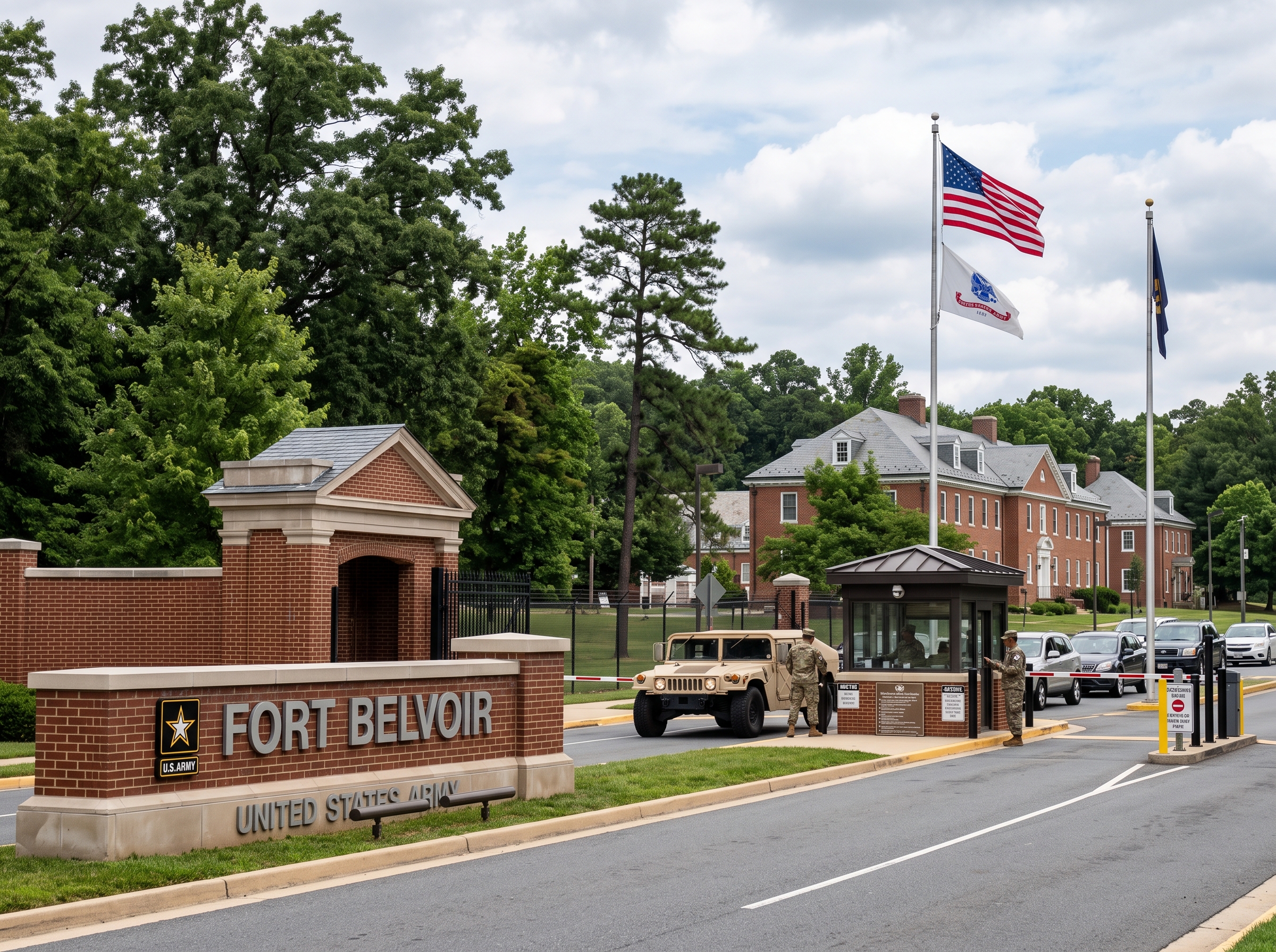
Executive Summary & Essential Community Takeaways
- Strategic Joint Defense & Intelligence Epicenter: Encompassing over 8,600 acres in southern Fairfax County, Fort Belvoir hosts pivotal Department of Defense agencies, including the Defense Logistics Agency (DLA) headquarters, the National Geospatial-Intelligence Agency (NGA) at Fort Belvoir North Area, the Defense Threat Reduction Agency (DTRA), and the Alexander T. Augusta Military Medical Center.
- Historic Plantation Origins: Occupies the historic 18th-century grounds of Belvoir Manor, the estate of William Fairfax frequently surveyed by young George Washington, before being established as Camp A.A. Humphreys in 1917 and formally designated Fort Belvoir in 1935.
- Privatized On-Post Villages & Off-Post Housing Corridors: Features 15 master-planned residential villages operated via the Military Housing Privatization Initiative (MHPI), flanked by contiguous civilian single-family and townhome submarkets in Kingstowne, Mount Vernon, Woodlawn, and Lorton.
- Protected Environmental Sanctuaries: Preserves over 1,300 acres of pristine freshwater tidal wetlands, hardwood forests, and bald eagle nesting preserves within the Accotink Bay Wildlife Refuge and Jackson Miles Abbott Wetland Sanctuary, complemented by marina access along Gunston Cove and the Potomac River.
- Dedicated On-Post FCPS Schools & IB World School Pyramid: Operates two modern elementary schools directly on-post (Fort Belvoir Primary and Fort Belvoir Upper) feeding into the Mount Vernon High School International Baccalaureate (IB) World School pyramid and Walt Whitman Middle School.
- Virginia Statutory Assessment Standards: Surrounding off-post private residential real property is evaluated under Virginia Code § 58.1-3201 at 100 percent of fair market value by the Fairfax County Department of Tax Administration (DTA) with semi-annual tax installments due on July 28 and December 5.
1. Spatial Morphology, Boundaries & Regional Geography
Fort Belvoir represents the largest single federal military reservation in Fairfax County, spanning more than 8,600 acres across southern Fairfax County along the scenic tidal shores of the Potomac River. Operating primarily within the Mount Vernon Magisterial District and extending into the Lee/Franconia Magisterial District (postal ZIP code 22060), the installation occupies a commanding position between Alexandria to the north and Prince William County to the southwest.
The installation's geographic footprint is organized into three primary operational components:
- Main Post: Bordered by Richmond Highway (U.S. Route 1) to the northwest, Telegraph Road to the northeast, Dogue Creek and the Mount Vernon peninsula to the east, and Gunston Cove and Pohick Bay to the south and west. Main Post contains the primary administrative headquarters, military hospital, residential villages, and riverfront facilities.
- Fort Belvoir North Area (FBNA): Situated north of Interstate 95 along the Fairfax County Parkway (Route 286) corridor, housing high-security intelligence installations including the sprawling headquarters of the National Geospatial-Intelligence Agency (NGA).
- Davison Army Airfield: An active military aviation facility situated west of Main Post providing rotary and fixed-wing air transportation support for military leadership and federal dignitaries.
2. Historical Evolution: 18th-Century Belvoir Manor, Camp A.A. Humphreys & Modern Joint Hub
The land encompassing Fort Belvoir has stood at the crossroads of American history for over three centuries, evolving from a prominent colonial plantation into one of the nation's preeminent joint defense installations.
Belvoir Manor & The Washington Connection
In 1741, William Fairfax, cousin and land agent of Thomas, 6th Lord Fairfax of Cameron, established Belvoir Manor overlooking the Potomac River. Belvoir was an opulent brick mansion featuring formal English gardens, wharves, and tobacco fields.
A teenage George Washington was a frequent guest at Belvoir, forming a lifelong friendship with William Fairfax's son, George William Fairfax, and learning the craft of land surveying under Fairfax family patronage. The mansion was destroyed by fire in 1783 and further damaged during the War of 1812; its stabilized historic foundation ruins remain preserved today on a picturesque bluff overlooking the Potomac River.
Camp A.A. Humphreys & The Corps of Engineers (1917–1988)
Following the entry of the United States into World War I in 1917, the federal government acquired the Belvoir peninsula to establish Camp A.A. Humphreys, named in honor of Major General Andrew A. Humphreys, a distinguished Union Army general and Chief of Engineers. The installation became the primary training ground for U.S. Army combat engineers.
In 1935, the post was formally renamed Fort Belvoir to honor its colonial heritage. For more than five decades, Fort Belvoir served as the global headquarters of the U.S. Army Engineer School, training hundreds of thousands of combat engineers and shaping military engineering doctrine through World War II, the Korean War, and the Vietnam conflict, prior to the school's relocation to Fort Leonard Wood in 1988.
The 2005 BRAC Transformation & Joint Defense Evolution
The 2005 Base Realignment and Closure (BRAC) Commission fundamentally transformed Fort Belvoir from a single-service training post into an elite multi-agency joint administrative, intelligence, and medical center. The post absorbed more than 20,000 defense personnel, bringing the National Geospatial-Intelligence Agency (NGA), the Defense Logistics Agency (DLA), and constructing the state-of-the-art Alexander T. Augusta Military Medical Center.
In 2020, Fort Belvoir welcomed the opening of the National Museum of the United States Army (NMUSA), an 84-acre cultural and educational landmark commemorating over 245 years of Army history.
3. Residential Enclaves, On-Post Villages & Off-Post Housing Corridors
Residential real estate in and around Fort Belvoir encompasses two complementary housing ecosystems: privatized on-post military villages and established civilian residential enclaves across southern Fairfax County.
| Residential Community / Submarket | Housing Typology & Architecture | Development Era | Tenure / Ownership Model | Fairfax County Zoning / Governance |
|---|---|---|---|---|
| Belvoir & River Villages (On-Post) | Historic Colonial Revival Brick Quarters & Executive Homes | 1928 – 1950s | Privatized Military Housing (Michaels) | Federal Military Cantonment |
| Lewis & Woodlawn Villages (On-Post) | Modern Townhomes & Contemporary Single-Family | 2004 – 2018 | Privatized Military Housing (LEED Certified) | Federal Military Cantonment |
| Kingstowne & Island Creek (Off-Post) | Colonial Single-Family, Townhomes & Condominiums | 1988 – 2005 | Fee-Simple Private Ownership | PDH (Planned Development Housing) |
| Mount Vernon & Woodlawn (Off-Post) | Mid-Century Ramblers, Split-Levels & Infill | 1955 – Present | Fee-Simple Private Residential | R-2 / R-3 / R-4 (Suburban Residential) |
| Lorton & Laurel Hill (Off-Post) | Traditional Craftsman, Brick Townhomes & Single-Family | 2002 – 2020 | Fee-Simple Private Ownership | PDH-3 / PDH-5 (Planned Communities) |
| Mason Neck Peninsula (Off-Post) | Waterfront Estates & Acreage Acreage Properties | 1965 – Present | Custom Private Acreage Estates | R-E / R-1 (Residential Estate / Conservation) |
Privatized On-Post Residential Villages
Through the Military Housing Privatization Initiative (MHPI), on-post housing at Fort Belvoir is managed by Fort Belvoir Residential Communities LLC, a private partnership with The Michaels Organization. The installation encompasses 15 distinct master-planned villages—including Belvoir Village, Woodlawn Village, Lewis Village, Dogue Creek Village, Fairfax Village, and River Village.
These neighborhoods integrate historic Georgian Revival brick residences for senior officers with contemporary, ENERGY STAR and LEED-certified townhomes and detached residences for active-duty families, supported by community center clubhouses, resort swimming pools, playgrounds, and dog parks.
Off-Post Civilian Residential Corridors
Many military families, civilian personnel, and private professionals choose to purchase private real estate in contiguous Fairfax County communities:
- Kingstowne / Telegraph Road Corridor: Situated five miles north, featuring master-planned amenities, extensive walking trails around Kingstowne Lake, golf facilities, and retail centers.
- Mount Vernon / Route 1 South County: Located immediately northeast, offering tree-lined mid-century neighborhoods with spacious lots and convenient access to the George Washington Memorial Parkway.
- Lorton / Laurel Hill: Situated immediately west along Route 1 and the Fairfax County Parkway, providing modern master-planned communities, the Laurel Hill Golf Club, and the Workhouse Arts Center.
- Mason Neck Peninsula: Located southwest along Gunston Cove, offering secluded estate acreage surrounded by Belmont Bay, Pohick Bay Regional Park, and Mason Neck State Park.
4. Structural Anatomy, Building Eras & Property Maintenance
Purchasing or evaluating residential real estate in the Fort Belvoir submarket requires technical familiarity with both historic mid-century coastal construction and modern energy-efficient building assemblies:
Mid-Century Masonry Single-Family Residences (1950–1975)
- Foundation Assemblies & Soil Mechanics: Properties in the Mount Vernon and Woodlawn corridors are frequently constructed with concrete masonry unit (CMU) crawl spaces or poured concrete basements situated in Marine Clay and coastal plain silt-loam soils. Maintaining proper grading slope away from foundations and installing functional gutters with extended downspouts is critical to prevent moisture intrusion and foundation settlement.
- Plumbing Supply & Sewer Inspections: Mid-century off-post homes originally utilized Type L copper supply lines and heavy cast iron drain-waste-vent (DWV) piping. Prospective purchasers should conduct a fiber-optic video camera sewer scope inspection of the sewer lateral from the cleanout to the street municipal main to detect internal corrosion, scale buildup, and tree root penetration from mature hardwood canopies.
- Electrical Service Infrastructure: Original installations often featured 60-amp or 100-amp electrical panels. Modern lifestyles require upgrading to a 200-amp circuit breaker panel with AFCI and GFCI protection to safely accommodate modern central heat pumps and electric vehicle charging equipment.
Modern Planned Community Construction (1990–Present)
- Engineered Assemblies: Modern homes in Kingstowne, Laurel Hill, and privatized post housing feature engineered floor trusses, multi-ply laminated veneer lumber (LVL) beams, and fiber-cement or high-durability vinyl siding over advanced housewrap moisture barriers.
- Thermal Envelopes & Dual-Zone HVAC: Homes are built with multi-zone variable-speed heat pumps, insulated double-pane Low-E argon-filled windows, and dense blown-in attic insulation achieving high thermal resistance.
5. Public Education Infrastructure: FCPS School Pyramids & Academic Profiles
Fort Belvoir and its surrounding residential communities are served exclusively by Fairfax County Public Schools (FCPS). Uniquely, the installation features two dedicated public elementary schools located directly on-post, operating in partnership with military leadership to support military-connected families.
| School Facility | Grade Levels | Location & Pyramidal Feeder | Academic Programs & Honors |
|---|---|---|---|
| Fort Belvoir Primary Elementary School | Pre-K – Grade 2 | On-Post / Mount Vernon Pyramid | Early Childhood Literacy, STEAM Focus, Purple Star Military-Friendly Campus |
| Fort Belvoir Upper Elementary School | Grades 3 – 6 | On-Post / Mount Vernon Pyramid | Advanced Academic Programs (AAP), STEAM Innovation Labs, Purple Star School |
| Walt Whitman Middle School | Grades 7 – 8 | Off-Post / Mount Vernon Pyramid | Honors Curriculum, AVID College Readiness, Engineering & Robotics Labs |
| Mount Vernon High School | Grades 9 – 12 | Off-Post / Mount Vernon Pyramid | Authorized International Baccalaureate (IB) World School, Full IB Diploma, Marine Corps JROTC |
| Hayfield Secondary School | Grades 7 – 12 | Off-Post / Hayfield Pyramid (Kingstowne Border) | Comprehensive Middle/High School, AP Capstone, STEM Initiatives |
| John R. Lewis High School | Grades 9 – 12 | Off-Post / Lewis Pyramid (North Border) | Authorized International Baccalaureate (IB) World School, Global Studies Focus |
The International Baccalaureate (IB) Diploma at Mount Vernon High
Mount Vernon High School is an authorized International Baccalaureate (IB) World School. Rather than limiting advanced students to individual AP tests, Mount Vernon offers the rigorous, two-year IB Diploma Programme. Students complete coursework across six subject groups, author a 4,000-word independent Extended Essay, complete the interdisciplinary Theory of Knowledge (TOK) capstone, and engage in community-focused Creativity, Activity, Service (CAS) projects.
Purple Star Designation & Military Family Support
Both Fort Belvoir Primary and Fort Belvoir Upper have earned the prestigious Virginia Department of Education Purple Star School Award. This distinction honors schools that demonstrate exceptional commitment to supporting military-connected children during frequent relocations, mid-year transitions, and parental deployments through dedicated peer transition ambassadors and specialized counseling staff.
6. Transportation Logistics, Commuter Corridors & Multimodal Transit
Fort Belvoir functions as a primary multimodal transit hub in southern Fairfax County, served by regional highway arterials, commuter rail networks, and express bus connections.
Major Highway Arterials & Expressways
- Richmond Highway (U.S. Route 1): The primary commercial and transit spine traversing Main Post, connecting Fort Belvoir northward to Alexandria, Reagan National Airport (DCA), and Washington, D.C., and southward to Woodbridge and Prince William County.
- Fairfax County Parkway (State Route 286): A high-capacity express parkway originating at Main Post and connecting directly to Fort Belvoir North Area, Interstate 95, Springfield, and the western Fairfax technology centers in Reston and Herndon.
- Interstate 95 / 395 / 495 Corridor: Accessible via the Fairfax County Parkway or Route 1, providing direct access to the 95 Express Lanes, the Capital Beltway, and the Pentagon.
- Telegraph Road (State Route 611): Offers an alternate north-south commuter route into Kingstowne, Franconia, and the City of Alexandria.
Commuter Rail & Metrorail Access
- Franconia-Springfield Metrorail & VRE Station: Situated approximately five miles north, providing access to the Metrorail Blue Line (direct to the Pentagon, Rosslyn, and downtown Washington, D.C.) and the Virginia Railway Express (VRE) Fredericksburg Line.
- Lorton VRE Station: Located approximately four miles west, offering commuter rail transit northward to Union Station in Washington, D.C., and hosting the Auto Train terminal.
- Embark Richmond Highway Bus Rapid Transit (BRT): An ongoing multi-million-dollar regional transit initiative creating dedicated median bus rapid transit lanes extending from the Huntington Metrorail Station directly to Fort Belvoir.
7. Environmental Topography, Potomac River Shoreline & Wildlife Sanctuaries
Covering over 8,600 acres along the tidal Fall Line of the Potomac River, Fort Belvoir is recognized as one of the most environmentally intact natural reservations in the Washington metropolitan area.
Accotink Bay Wildlife Refuge & Jackson Abbott Sanctuary
Fort Belvoir protects more than 1,300 contiguous acres of sensitive tidal wetlands, hardwood forests, and freshwater marshes within two designated natural areas:
- Accotink Bay Wildlife Refuge: Encompasses over 1,300 acres of undisturbed riverine wetlands along Accotink Creek and Gunston Cove. The refuge provides more than eight miles of scenic nature hiking trails, observation overlooks, and critical nesting habitat for bald eagles, osprey, great blue herons, and beaver populations.
- Jackson Miles Abbott Wetland Sanctuary: A protected 150-acre freshwater wetland preserve named after the renowned ornithologist, featuring self-guided interpretive boardwalk trails and wildlife observation decks.
Potomac River Waterfront & Marina Facilities
Fort Belvoir boasts miles of scenic shoreline along Gunston Cove, Pohick Bay, and the main Potomac River stem. The installation maintains the Fort Belvoir Marina, offering boat slips, dry boat storage, kayak/canoe rentals, boat launch ramps, and fishing piers for authorized patrons, with direct water access to George Washington's Mount Vernon estate and the Chesapeake Bay.
8. Real Estate Assessment Cycles & Virginia Statutory Tax Framework
Understanding the real estate tax framework in the Fort Belvoir region requires distinguishing between constitutionally exempt federal cantonment lands and contiguous private residential property.
Federal Sovereignty vs. Off-Post Private Taxation
Land situated within the federal boundaries of Fort Belvoir is owned by the United States Government and is constitutionally immune from state and local property taxation under the Supremacy Clause of the United States Constitution. However, all private, fee-simple residential real estate situated in surrounding off-post communities—such as Kingstowne, Mount Vernon, Woodlawn, and Lorton—is governed strictly under the tax laws of the Commonwealth of Virginia and Fairfax County.
Virginia Code Title 58.1-3201: The 100% Fair Market Value Mandate
Under Virginia Code § 58.1-3201, all real property in Virginia must be assessed for tax purposes at one hundred percent (100%) of its true fair market value. The Fairfax County Department of Tax Administration (DTA) conducts comprehensive annual reassessments of every taxable parcel in the Fort Belvoir submarket. Valuations are determined through mass appraisal market equalization based on verified arm's-length sales of comparable properties within identical neighborhood submarket codes.
Annual Assessment Calendar & Payment Schedules
- January 1 (Statutory Effective Date): Property assessments are legally established as of January 1 of each calendar year, reflecting market transactions occurring during the preceding twelve months.
- Late February (Mailing of Assessment Notices): The DTA mails official Notice of Real Estate Assessment cards to all property owners, itemizing land value, building value, and total equalized taxable valuation.
- Semi-Annual Payment Deadlines: Real estate tax payments in Fairfax County are billed in two equal installments:
- First Installment: Statutorily due on or before July 28.
- Second Installment: Statutorily due on or before December 5.
- Countywide Dedicated Levies: Properties in the Fort Belvoir area are subject to the Countywide Stormwater Management Service District Tax, dedicated to stream valley restoration, dam safety, and Chesapeake Bay runoff mitigation.
Statutory Assessment Appeals Mechanism
Property owners who believe their annual assessment exceeds fair market value, is non-uniform compared to contiguous properties, or contains clerical errors have the legal right to challenge the assessment through a formal two-tiered process:
- Administrative Review: An informal appeal submitted directly to the Department of Tax Administration, typically required by early April. An assigned county residential appraiser reviews structural data, square footage calculations, physical property condition, and relevant sales comps.
- Board of Equalization (BOE) Appeal: A formal evidentiary appeal submitted to the citizen-led Board of Equalization of Real Estate Assessments, typically requiring filing by June 1. If dissatisfied with the BOE ruling, property owners retain the statutory right to file a petition with the Circuit Court of Fairfax County under Virginia Code § 58.1-3984.
9. Frequently Asked Questions Regarding Fort Belvoir, VA Real Estate
Is Fort Belvoir a municipality or a federal military installation in Fairfax County?
Fort Belvoir is a major United States Army military installation and federal cantonment spanning over 8,600 acres in southern Fairfax County, primarily situated within the Mount Vernon Magisterial District. The surrounding census-designated place (CDP) encompasses postal ZIP code 22060 and contiguous civilian communities governed directly by the Fairfax County Board of Supervisors.
What was the historical origin of Fort Belvoir?
The installation sits upon the historic 18th-century Belvoir Manor plantation owned by William Fairfax, cousin of Lord Thomas Fairfax. Young George Washington frequently surveyed the estate and socialized with the Fairfax family. During World War I in 1917, the federal government established Camp A.A. Humphreys as an engineer training facility, which was formally renamed Fort Belvoir in 1935 in honor of the historic plantation.
How is residential housing organized on Fort Belvoir?
On-post housing is operated through the Department of Defense Military Housing Privatization Initiative by Fort Belvoir Residential Communities LLC (a partnership with The Michaels Organization). The installation features 15 master-planned residential villages comprising thousands of homes ranging from historic brick colonial revival officers' quarters to modern high-efficiency townhomes and single-family dwellings.
What off-post residential communities surround Fort Belvoir?
Service members, defense civilians, and contractors reside across established contiguous residential submarkets in Fairfax County, including Kingstowne and Island Creek to the north, Mount Vernon, Woodlawn, and Fort Hunt along the historic George Washington Memorial Parkway corridor to the east, and Lorton, Laurel Hill, and Mason Neck to the southwest.
Which public schools serve families at Fort Belvoir?
Fort Belvoir features two dedicated on-post elementary schools operated by Fairfax County Public Schools (FCPS): Fort Belvoir Primary Elementary (Pre-K to Grade 2) and Fort Belvoir Upper Elementary (Grades 3 to 6). Secondary students attend Walt Whitman Middle School and Mount Vernon High School, an authorized International Baccalaureate (IB) World School offering the full IB Diploma Programme.
What major military, medical, and intelligence commands are headquartered at Fort Belvoir?
Fort Belvoir serves as a joint strategic defense headquarters, hosting the Defense Logistics Agency (DLA) headquarters, the Defense Threat Reduction Agency (DTRA), the National Geospatial-Intelligence Agency (NGA) headquarters at Fort Belvoir North Area, U.S. Army Intelligence and Security Command (INSCOM), and the Alexander T. Augusta Military Medical Center.
What environmental preserves and recreation areas exist on the installation?
Fort Belvoir preserves over 1,300 acres of protected natural habitat, including the Accotink Bay Wildlife Refuge and the Jackson Miles Abbott Wetland Sanctuary. Amenities include scenic shoreline hiking trails, bald eagle nesting preserves, the Fort Belvoir Marina along the Potomac River and Gunston Cove, and multiple outdoor sports facilities.
What cultural and historic attractions are located at or near Fort Belvoir?
Fort Belvoir is home to the landmark 84-acre campus of the National Museum of the United States Army (NMUSA). Adjacent historic sites along Route 1 include George Washington's Mount Vernon estate, Woodlawn Historic Site (originally part of Mount Vernon), Frank Lloyd Wright's Pope-Leighey House, and historic Pohick Church (1774).
How is commuter transit structured between Fort Belvoir and Washington, D.C.?
Commuter access is anchored by Richmond Highway (U.S. Route 1), the Fairfax County Parkway (Route 286), Interstate 95, and Telegraph Road. Multimodal transit includes express bus routes connecting directly to the Franconia-Springfield Metrorail (Blue Line) and VRE commuter rail station, along with the planned Embark Richmond Highway Bus Rapid Transit (BRT) extension.
How does real estate property taxation apply to Fort Belvoir and surrounding areas?
Federal installation land is constitutionally exempt from local property taxation. However, private residential properties located in off-post civilian enclaves are subject to annual real estate assessments conducted by the Fairfax County Department of Tax Administration (DTA) under Virginia Code § 58.1-3201 at 100 percent of fair market value, with taxes paid semi-annually on July 28 and December 5.
10. Academic References, Military Archives & Statutory Legal Disclaimers
This architectural monograph, environmental assessment, and regional real estate reference treatise incorporates verified historical archives, public planning documents, and statutory legal frameworks:
- United States Army Corps of Engineers (USACE): Fort Belvoir Master Plan & Historical Cantonment Architectural Survey, Directorate of Public Works, Fort Belvoir, Virginia.
- Fairfax County Comprehensive Plan: Area IV, Mount Vernon Magisterial District Plan & Fort Belvoir Community Planning Sector, Fairfax County Department of Planning and Development, Fairfax, Virginia.
- National Museum of the United States Army (NMUSA): Historical Exhibits, Belvoir Manor Archaeological Records, and Camp A.A. Humphreys Archives, Fort Belvoir, Virginia.
- Fairfax County Public Schools (FCPS): Office of Facilities Planning, Mount Vernon High School and Hayfield Secondary School Feeder Boundary Alignment Directory, Gatehouse Administration Center, Falls Church, Virginia.
- Code of Virginia (Statutory Authority): Title 58.1 (Taxation), § 58.1-3201 (Fair Market Value Mandates) and § 58.1-3370 (Board of Equalization Procedures), Commonwealth of Virginia, Richmond, Virginia.
- United States Geological Survey (USGS): Fort Belvoir and Mount Vernon 7.5-Minute Topographic Quadrangles, Accotink Bay Hydrologic Surveys, Reston, Virginia.
Statutory Research & Regulatory Notice: This architectural monograph, environmental review, and submarket treatise is published strictly for informational, educational, and spatial orientation purposes. Real estate boundaries, military housing eligibility, school attendance zones, park access, and tax assessment schedules are subject to ongoing administrative modifications by the Department of Defense, the Fairfax County Board of Supervisors, the Fairfax County School Board, and the Virginia Department of Transportation (VDOT). This publication does not constitute formal appraisal valuations, structural architectural inspections, or legal counsel. Prospective purchasers and property owners must verify official parcel-specific records directly with the Fairfax County Department of Tax Administration (DTA) and Land Development Services (LDS).