
Mount Vernon, VA Real Estate: The Definitive Guide to Potomac Riverfront Estates, Historic Conservation & the Richmond Highway Corridor
1. Executive Summary & Foundational Takeaways
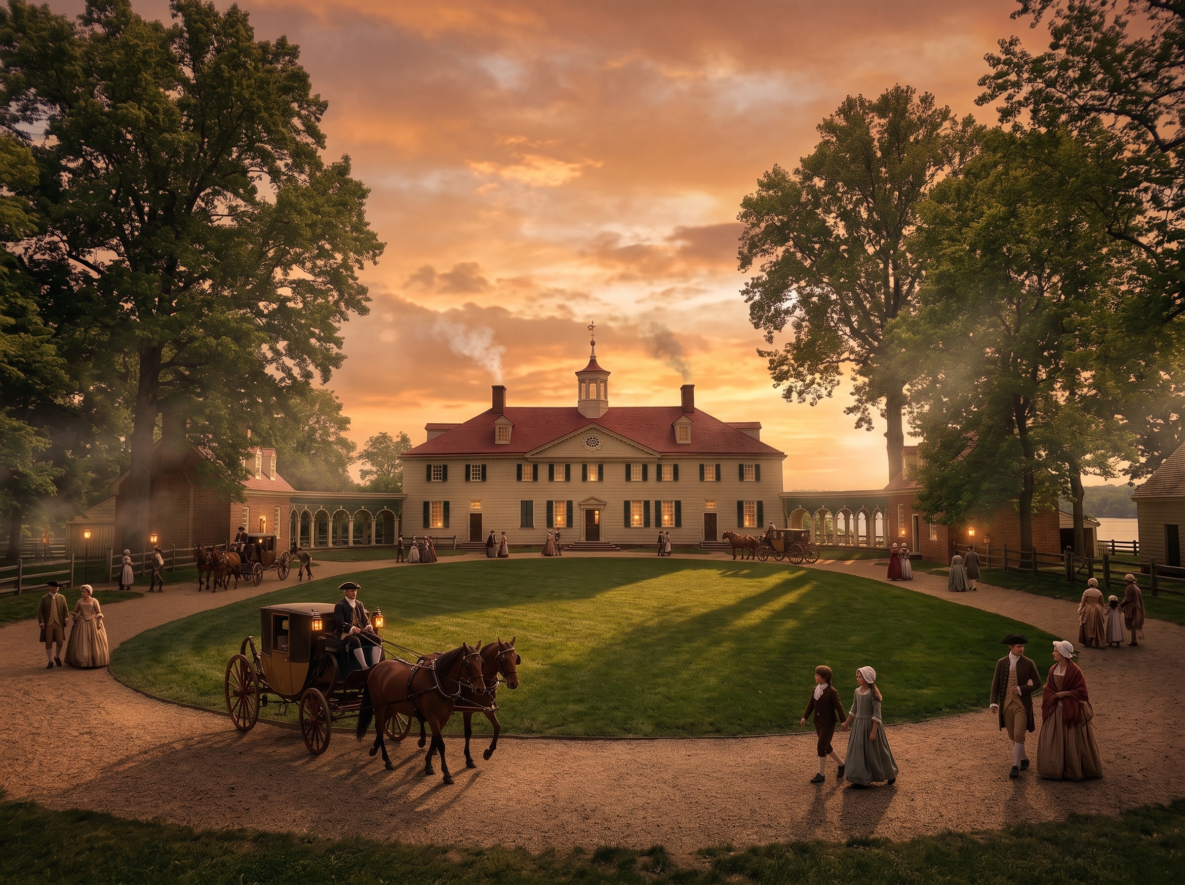
Mount Vernon, Virginia, occupies one of the most historically consecrated and geographically privileged landscapes in the United States. Situated along the western banks of the tidal Potomac River in southeastern Fairfax County, this unincorporated community within the Mount Vernon Magisterial District (primarily encompassing postal ZIP codes 22309 and 22308) blends colonial historic stewardship with exclusive waterfront living and strategic proximity to regional federal defense nodes.
Named after George Washington's historic estate and plantation, Mount Vernon is defined by an enduring spatial equilibrium. The community deliberately avoids high-density commercial overdevelopment, preserving mature oak canopies, estuarine creek inlets, and low-density residential zoning. Simultaneously, its western fringe along Route 1 (Richmond Highway) is undergoing visionary infrastructure modernization through the county's multimodal Embark Richmond Highway initiative, creating future bus rapid transit (BRT) access while safeguarding peaceful riverfront enclaves.
Because Mount Vernon operates as an unincorporated census-designated place (CDP) under the direct governance of the Fairfax County Board of Supervisors, property owners benefit from unified county administration, premier public school programming within the Mount Vernon High School International Baccalaureate (IB) pyramid, and world-class county emergency infrastructure without the imposition of separate incorporated town levies.
The Six Structural Pillars of Mount Vernon Real Estate
- Potomac Riverfront & Riparian Privileges. Prime deep-water access, private residential piers, and panoramic tidal views along Little Hunting Creek and the main Potomac shipping channel, offering a nautical lifestyle unmatched in Fairfax County.
- Colonial Heritage & Historic Conservation. Anchored by George Washington's Mount Vernon Estate, Woodlawn Plantation, Frank Lloyd Wright's Pope-Leighey House, and Washington's Gristmill, fortified by protective Historic Overlay Districts (HODs).
- Defense & Institutional Economic Anchors. Immediate adjacency to Fort Belvoir—headquarters of the Defense Logistics Agency (DLA), Belvoir Community Hospital, and neighboring National Geospatial-Intelligence Agency (NGA)—generating permanent non-cyclical housing demand.
- Scenic George Washington Memorial Parkway. Direct vehicular and active commuter access along the National Park Service scenic highway and 18-mile Mount Vernon Trail, connecting directly to Old Town Alexandria, Reagan National Airport, and Washington, D.C.
- Architectural Breadth & Mature Canopies. A distinguished spectrum ranging from multi-acre riverfront custom estates to celebrated mid-century modernist neighborhoods (Waynewood, Stratford Landing) and contemporary infill residences.
- Chesapeake Bay Environmental Buffering. Strict statutory 100-foot Resource Protection Area (RPA) buffers under the Chesapeake Bay Preservation Act, preserving natural stream valleys, estuarine ecology, and property values.
2. Comprehensive Historical Evolution
The narrative of Mount Vernon is inextricably intertwined with the founding of the American republic and the spatial planning of colonial Virginia. In the seventeenth and eighteenth centuries, the land was subdivided into expansive tobacco plantations along the navigable tidal waterways of the Potomac River, Little Hunting Creek, and Dogue Creek.
The Washington Estate & Agrarian Landscape
In 1754, George Washington leased the Mount Vernon estate from his sister-in-law, formally acquiring complete ownership in 1761. Over four decades, Washington expanded the original modest 1.5-story farmhouse into the iconic 21-room Palladian mansion, distinguished by its high-columned piazza overlooking the river and rusticated wooden siding treated with sand to emulate cut ashlar stone. He enlarged the contiguous landholdings to more than 8,000 acres, subdivided into five functioning farms: Mansion House Farm, Dogue Run Farm, Muddy Hole Farm, River Farm, and Union Farm.
Washington shifted the agricultural economic model away from soil-depleting tobacco to complex crop rotation with wheat, establishing an innovative merchant gristmill and one of the largest commercial whiskey distilleries in eighteenth-century North America. Following his death in 1799, the vast plantation was distributed among heirs, gradually subdividing into smaller agrarian tracts.
Preservation Vanguard & 20th-Century Maturation
In 1858, Ann Pamela Cunningham founded the Mount Vernon Ladies' Association, the nation's first historic preservation organization, which purchased the mansion and 200 core acres to rescue the estate from decay. The completion of the George Washington Memorial Parkway in 1932 to commemorate the bicentennial of Washington's birth permanently established a scenic, protected commuter corridor linking Mount Vernon with Alexandria and Washington, D.C.
In the post-World War II era, the remaining farmland and estate parcels evolved thoughtfully into premier suburban and custom riverfront neighborhoods. Rather than succumbing to uniform tract developments, subdivisions such as Waynewood, Stratford Landing, and Yacht Haven were master-planned with generous lot widths, dedicated parkland dedications, and strict covenants respecting the riverfront topography.
3. Potomac Riverfront, Peninsulas & Riparian Real Estate
Waterfront real estate in Mount Vernon represents one of Northern Virginia's most coveted micro-markets. Framed by the expansive tidal basin of the Potomac River and the sheltered estuarine waters of Little Hunting Creek and Dogue Creek, properties in this tier provide a nautical lifestyle that is largely unavailable in landlocked interior Fairfax County communities.
Yacht Haven & Mount Vernon on the Potomac
Neighborhoods such as Yacht Haven and Mount Vernon on the Potomac feature deep-water access channels, private residential boat slips, and deeded riparian rights. Property owners can dock motor yachts, sailboats, and recreational watercraft at their rear property line, providing direct navigation out to the main Potomac River channel, the Chesapeake Bay, and the Atlantic Ocean. Architectural profiles here encompass custom brick manor homes, grand coastal shingle-style estates, and contemporary glass-walled residences designed to maximize 180-degree water vistas.
Little Hunting Creek & Estuarine Shorelines
Along the meandering banks of Little Hunting Creek, riparian estates enjoy serene, protected waters ideal for paddleboarding, kayaking, and tidal fishing. The shoreline dynamic creates a micro-climate of cooling summer breezes and picturesque seasonal waterfowl migrations, attracting high-net-worth buyers seeking privacy and nature while maintaining a straightforward commute to downtown employment centers.
4. Historic Landmarks & Cultural Anchors
Mount Vernon's civic atmosphere is enriched by an extraordinary density of nationally significant historic institutions that provide cultural programming and preserve green viewsheds:
- George Washington's Mount Vernon: A 500-acre preserved historic campus featuring the restored mansion, tomb, slave memorial, historic outbuildings, pioneer farm, and the Fred W. Smith National Library for the Study of George Washington. Operates entirely without government funding as a privately maintained non-profit national treasure.
- Woodlawn Plantation: Originally an estate carved from Washington's lands as a wedding gift for his step-granddaughter Nelly Custis and nephew Lawrence Lewis. Designed by Dr. William Thornton (first architect of the U.S. Capitol), Woodlawn became the first property acquired by the National Trust for Historic Preservation in 1952.
- Frank Lloyd Wright's Pope-Leighey House: Located on the grounds of Woodlawn, this 1940 Usonian residence is an architectural masterpiece of organic design, radiant heated concrete floors, cypress paneling, and clerestory patterned glass.
- George Washington's Gristmill & Distillery: A functioning reconstruction of Washington's water-powered gristmill and copper-pot whiskey distillery, interpreting late eighteenth-century agricultural engineering.
5. Housing Stock Typologies & Architectural Stratification
The residential fabric of Mount Vernon spans more than seven decades of deliberate residential construction, offering four primary housing typologies:
1. Custom Waterfront & Estate Residences
Positioned along the Potomac River shoreline and peninsular cul-de-sacs, these residences occupy parcels ranging from half-acre sites to multi-acre gated compounds. Constructed from hand-laid brick, native Virginia stone, and natural cedar, they showcase multi-car side-entry garages, elevator-served multi-level layouts, outdoor kitchens, infinity-edge swimming pools, and private deep-water piers.
2. Mid-Century Modern & Classic Post-War Subdivisions
Communities such as Waynewood, Stratford Landing, and Riverside Gardens were largely established between the mid-1950s and early 1970s. Housing stock features solid brick single-story ramblers, split-levels, and colonial revivals situated on mature quarter- to third-acre lots. These enclaves are characterized by neighborhood civic associations, community swimming pools, tennis clubs, and wide tree-lined sidewalks.
3. Bespoke Contemporary Infill Architecture
As the desirability of Mount Vernon's established parcels has intensified, builders have selectively acquired older modest structures to construct modern custom homes. These infill properties feature modern craftsman, transitional colonial, and modern farmhouse designs with 9- to 10-foot ceilings, chef-grade kitchens, wide-plank hardwood flooring, and energy-efficient building envelopes.
4. Boutique Townhome & Condominium Enclaves
Situated primarily along secondary connectors near Fort Hunt Road and the Route 1 corridor, these fee-simple townhomes and garden-style condominiums cater to military personnel stationed at Fort Belvoir, downscaling empty-nesters, and professionals seeking low-maintenance living with immediate access to regional transit routes.
6. Institutional & Military Economic Anchors
Mount Vernon's housing market is heavily insulated from broader economic volatility by the presence of major federal and healthcare anchors:
- Fort Belvoir Military Garrison: Located immediately southwest of Mount Vernon, Fort Belvoir is one of the premier military installations in the National Capital Region. It hosts key departmental headquarters including the Defense Logistics Agency (DLA), the Defense Threat Reduction Agency (DTRA), major elements of the U.S. Army Materiel Command, and the Alexander T. Augusta Military Medical Center (formerly Fort Belvoir Community Hospital). The base generates year-round relocation demand from military officers, senior civilian DoD executives, and aerospace contractors.
- National Geospatial-Intelligence Agency (NGA): Situated adjacent to Fort Belvoir at New Campus East, this massive intelligence headquarters employs thousands of cleared intelligence professionals, geographers, and data scientists who commute from Mount Vernon.
- Inova Mount Vernon Hospital: A 237-bed acute-care community hospital featuring the renowned Inova Joint Replacement Center, the Inova Rehabilitation Center, and hyperbaric wound healing facilities, anchoring the local medical employment sector.
7. Zoning, Land-Use Governance & Historic Overlays
Land use across Mount Vernon is strictly administered under the Fairfax County Zoning Ordinance (zMOD), ensuring the preservation of the community's suburban and natural character:
Standard Residential Classifications
The prevailing zoning classifications are R-E (Residential Estate), R-1 (One dwelling unit per acre), R-2 (Two dwelling units per acre), and R-3 (Three dwelling units per acre). These low-density designations preserve generous lot frontages, enforce strict front-, side-, and rear-yard setback requirements, and regulate maximum lot coverage to prevent overcrowding.
Historic Overlay Districts (HODs)
Fairfax County has established formal Historic Overlay Districts surrounding Mount Vernon and Woodlawn. Any new construction, substantial alteration, or demolition within these overlay zones is subject to rigorous review by the Fairfax County Architectural Review Board (ARB). The ARB evaluates building heights, architectural massing, exterior materials, rooflines, and vegetative screening to guarantee that surrounding development harmonizes with historic vistas and avoids visual degradation of national landmarks.
8. Environmental Regulation: Chesapeake Bay Act & Stream Valleys
Because Mount Vernon borders tidal estuarine waters, environmental land-use controls are exceptionally stringent. The community falls under the jurisdiction of the Chesapeake Bay Preservation Act, implemented locally via Fairfax County's Chesapeake Bay Preservation Ordinance.
Statutory Resource Protection Areas (RPAs) extend 100 feet landward from the ordinary high-water mark of the Potomac River, Little Hunting Creek, Dogue Creek, and their contiguous tidal wetlands. Within the 100-foot RPA buffer, the removal of indigenous vegetation, ground clearing, and construction of new impervious footprints are strictly regulated and require formal county environmental waivers, Water Quality Impact Assessments (WQIAs), and vegetative mitigation plans. These safeguards preserve shoreline stabilization, mitigate flooding risks, and protect aquatic habitats.
9. Multimodal Transportation & Commuter Arteries
Mount Vernon provides a sophisticated transportation network balancing scenic leisure drives with rapid regional arterial connectivity:
George Washington Memorial Parkway & Mount Vernon Trail
The northern terminus of George Washington's estate serves as the southern anchor of the George Washington Memorial Parkway. This scenic four-lane parkway, maintained by the National Park Service, provides an uninterrupted commute along the river into Old Town Alexandria, Reagan National Airport, Crystal City (National Landing), and downtown Washington, D.C., completely free of commercial billboards and heavy truck traffic. Running parallel is the paved 18-mile Mount Vernon Trail, serving thousands of active bicycle and pedestrian commuters daily.
The Richmond Highway (Route 1) Corridor & Embark BRT
To the west, Route 1 (Richmond Highway) provides direct access north to Interstate 495 (Capital Beltway) and south to Woodbridge and Prince William County. The corridor is currently the focus of Embark Richmond Highway, Fairfax County's premier multi-billion-dollar infrastructure modernization project. The initiative will introduce dedicated median-running Bus Rapid Transit (BRT)—branded as The One—connecting Fort Belvoir and Mount Vernon directly with the Huntington Metrorail Station on the WMATA Yellow Line.
10. Public Education & Academic Pyramids
Mount Vernon is served by the nationally recognized Fairfax County Public Schools (FCPS) system, organized within the Mount Vernon High School educational pyramid:
Mount Vernon High School (IB World School)
Mount Vernon High School is an authorized International Baccalaureate (IB) World School, offering the rigorous IB Diploma Programme that prepares students for competitive collegiate admissions through advanced multidisciplinary coursework. The school also features advanced career and technical academies, competitive STEM curricula, comprehensive athletic facilities, and fine arts programs.
Middle & Elementary Feeder Network
The high school is fed primarily by Carl Sandburg Middle School (home to the Advanced Academic Program / AAP center) and Walt Whitman Middle School. Elementary feeder schools include celebrated neighborhood institutions such as Waynewood Elementary School (frequently cited for exceptional parent engagement and academic performance), Stratford Landing Elementary School, Fort Hunt Elementary School (offering Spanish Dual Language Immersion), Riverside Elementary School, and Washington Mill Elementary School.
11. Parks, Estuarine Ecology & Outdoor Recreation
Mount Vernon offers an abundance of preserved open space and waterfront recreation:
- Dyke Marsh Wildlife Preserve: Managed by the National Park Service, this 485-acre freshwater tidal wetland is one of the last remaining significant natural marshes along the upper Potomac. It features boardwalk nature trails and exceptional birdwatching for bald eagles, ospreys, and migratory waterbirds.
- Fort Hunt Park: A historic 1890s coastal artillery fortification that now provides sprawling open picnic lawns, athletic fields, historic battery fortifications, and river views.
- Mount Vernon Country Club: A private members' club featuring an 18-hole championship golf course carved into the rolling wooded terrain of George Washington's original forest holdings, complete with dining, tennis, and social facilities.
- Little Hunting Creek & Belle Haven Marina: Direct boat ramps, sailing schools, kayak rentals, and slips for powerboats and sailing vessels navigating the Potomac River.
12. Comprehensive Submarket Matrix Table
The table below illustrates the key residential sub-pockets comprising the Mount Vernon real estate landscape, contrasting architectural typologies, lot dimensions, transit orientations, and governance models:
| Submarket / Enclave | Primary Architectural Typology | Dominant Construction Era | Density & Lot Size Profile | Transit / Riparian Profile | Governance & HOA Model |
|---|---|---|---|---|---|
| Potomac & Creek Riverfront Estates | Custom Waterfront Manors, Coastal Shingle, Transitional Estates | 1960s to Contemporary Custom Infill | Low Density; 0.5 to 2.0+ Acres | Deep-Water Riparian Piers, Private Boat Docks | Deeded Riparian Rights; Mixed Civic / Non-HOA |
| Waynewood & Stratford Landing | Mid-Century Brick Ramblers, Split-Levels, Expanded Colonials | 1950s – 1975 (with Modern Infill) | Medium-Low Density; 0.25 to 0.4 Acres | GW Parkway & Fort Hunt Road; Bike Commuter Trails | Active Voluntary Civic Associations, Pool Clubs |
| Mount Zephyr & Mount Vernon Woods | Traditional Brick Ranches, Cape Cods, Transitional Infill | 1950s – 1980s | Medium Density; 0.2 to 0.35 Acres | Proximity to Route 1 Arterials & Bus Routes | Predominantly Non-HOA Fee-Simple Ownership |
| Route 1 Multimodal Corridor | Multi-Level Fee-Simple Townhomes, Garden Condominiums | 1980s – Present | Medium-High Density; Clustered Urban Lots | Direct Route 1 & Future Embark BRT Station Walkability | Mandatory Community Associations (POAA & Condominium Acts) |
| Historic Woodlawn & Polo Grounds Periphery | Custom Country Estates, Colonial Reproductions, Horse Properties | 1970s – Contemporary Custom | Very Low Density; 1.0 to 5.0+ Acres | Route 1 / Route 235 Access; Buffer to Fort Belvoir | Fairfax County HOD & ARB Architectural Oversight |
13. Taxation, Civic Governance & Riparian Permitting
Mount Vernon operates under the unified statutory framework of Fairfax County, ensuring administrative efficiency:
Ad Valorem Real Estate Assessment Mechanism
Real estate in Mount Vernon is assessed annually at 100% fair market value by the Fairfax County Department of Tax Administration (DTA) in strict accordance with Virginia Code Title 58.1. Real property taxes are billed semi-annually. Because Mount Vernon is not an incorporated town, property owners pay only the unified county real estate tax and applicable countywide service levies (e.g., stormwater management), avoiding secondary municipal town taxes.
Riparian Dock & Pier Permitting Jurisdictions
Constructing, enlarging, or replacing a residential pier, boat lift, or bulkhead along the tidal Potomac or Little Hunting Creek involves a multi-jurisdictional permitting process. Homeowners must secure approvals through the Virginia Marine Resources Commission (VMRC), the U.S. Army Corps of Engineers (USACE) Norfolk District, the Fairfax County Wetlands Board, and the county Department of Land Development Services (LDS) to verify compliance with navigation channel clearances and tidal wetlands preservation.
14. 10 Comprehensive Evergreen FAQs
1. Is Mount Vernon an incorporated town or an unincorporated area of Fairfax County?
Mount Vernon is an unincorporated census-designated place (CDP) situated entirely within the Mount Vernon Magisterial District of Fairfax County. It has no independent town charter or town council. Municipal administration, emergency services, public schools, and property taxation are managed directly by Fairfax County, meaning homeowners pay only countywide real estate levies without municipal town surcharges.
2. What architectural home styles define Mount Vernon real estate?
Mount Vernon features diverse architectural typologies spanning distinct developmental eras: custom riverfront estates and colonial revival mansions along the Potomac River, mid-century brick ramblers and split-levels in established neighborhoods like Waynewood and Stratford Landing, custom mid-century modern and contemporary homes, and modern infill estates on quarter-acre to multi-acre lots.
3. What environmental regulations affect Potomac Riverfront and creek-adjacent properties?
Riverfront parcels bordering the Potomac River, Little Hunting Creek, and Dogue Creek are governed by the Chesapeake Bay Preservation Act and Fairfax County's Chesapeake Bay Preservation Ordinance. Properties fall within statutory 100-foot Resource Protection Areas (RPAs), which impose strict restrictions on land disturbance, impervious surface additions, and tree removal to preserve water quality and estuarine bank stability.
4. How does Fort Belvoir impact residential demand in Mount Vernon?
Fort Belvoir borders Mount Vernon immediately to the southwest and is one of Northern Virginia's largest military and defense installations, housing the Defense Logistics Agency (DLA), the National Geospatial-Intelligence Agency (NGA) New Campus East nearby, and Belvoir Community Hospital. It generates substantial, non-cyclical housing demand from military flag officers, federal civilian leadership, defense contractors, and healthcare professionals.
5. What are the primary commuter corridors connecting Mount Vernon to Washington, D.C.?
The primary scenic commuter artery is the George Washington Memorial Parkway, offering an uninterrupted drive north along the Potomac River into Old Town Alexandria, Reagan National Airport, and Washington, D.C. The western sector is anchored by Route 1 (Richmond Highway), while the Huntington Metrorail Station (Yellow Line) serves as the closest heavy-rail transit hub, supplemented by Fairfax Connector express bus service.
6. What is the Embark Richmond Highway project and how does it affect Mount Vernon?
Embark Richmond Highway is Fairfax County's transformative multimodal initiative to revitalize the Route 1 corridor. It includes dedicated median-running Bus Rapid Transit (BRT)—known as The One—linking Fort Belvoir and Mount Vernon directly to the Huntington Metrorail Station, accompanied by protected pedestrian and cycling facilities and mixed-use urban town center redevelopment.
7. Which public schools serve the Mount Vernon community?
Mount Vernon is served by Fairfax County Public Schools (FCPS) within the Mount Vernon High School pyramid. Mount Vernon High School is an authorized International Baccalaureate (IB) World School offering the rigorous IB Diploma Programme. Feeder schools include Carl Sandburg Middle School and acclaimed elementary schools such as Waynewood, Stratford Landing, and Fort Hunt Elementary.
8. Are private boat docks and riparian rights permitted along Little Hunting Creek and the Potomac?
Select waterfront properties along Little Hunting Creek and the Potomac shoreline hold deeded riparian rights allowing private deep-water or tidal piers. Construction and maintenance of private docks require joint statutory permits from the Virginia Marine Resources Commission (VMRC), the U.S. Army Corps of Engineers (USACE), and the Fairfax County Department of Land Development Services.
9. What are the Mount Vernon and Woodlawn Historic Overlay Districts (HODs)?
Fairfax County maintains specialized Historic Overlay Districts surrounding George Washington's Mount Vernon Estate and Woodlawn Plantation. Properties inside or bordering these districts are subject to enhanced architectural review, building height limits, setback standards, and vegetative buffering to safeguard the historic viewsheds and pastoral character of these national landmarks.
10. Do neighborhoods in Mount Vernon have mandatory HOAs?
Many of Mount Vernon's established mid-century and custom subdivisions (such as sections of Waynewood, Stratford Landing, and older riverfront streets) operate without mandatory HOAs, giving owners architectural flexibility within Fairfax County zoning parameters. Some communities maintain voluntary civic associations that manage neighborhood pools, tennis facilities, and community events, while newer townhome enclaves have mandatory associations.
15. Legal & Fair Housing Disclaimer
This real estate and community monograph is published strictly for informational, educational, and demographic research purposes. All municipal boundaries, zoning districts, school attendance zones, tax assessments, and transit plans are derived from official Fairfax County public records, the Virginia Department of Transportation (VDOT), the National Park Service (NPS), and the Code of Virginia, and are subject to periodic administrative modification. Prospective purchasers, sellers, and investors must independently examine official property disclosures, deed encumbrances, riparian permits, and zoning codes through licensed legal and real estate professionals prior to executing contractual agreements. This publication strictly adheres to Title VIII of the Civil Rights Act of 1968 (The Federal Fair Housing Act) and the Virginia Fair Housing Law, prohibiting discrimination on the basis of race, color, religion, sex, handicap, familial status, elderliness, or national origin.